


ANDERSON, Warrick County, Indiana
About
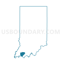
Outline

Summary
| Unique Area Identifier | 581109 |
| Name | ANDERSON |
| County | Warrick County |
| State | Indiana |
| Area (square miles) | 22.13 |
| Land Area (square miles) | 20.72 |
| Water Area (square miles) | 1.41 |
| % of Land Area | 93.63 |
| % of Water Area | 6.37 |
| Latitude of the Internal Point | 37.93375860 |
| Longtitude of the Internal Point | -87.30285220 |
Maps


Graphs
Select a template below for downloading or customizing gragh for ANDERSON, Warrick County, Indiana


Neighbors
Neighoring Voting District (by Name) Neighboring Voting District on the Map
- BOON 09, Warrick County, IN
- BOON 10, Warrick County, IN
- LUCE 01, Spencer County, IN
- LUCE 02, Spencer County, IN
- LUCE 03, Spencer County, IN
- OHIO 01, Warrick County, IN
- OHIO 19, Warrick County, IN
- OHIO 26, Warrick County, IN
Top 10 Neighboring County Subdivision (by Population) Neighboring County Subdivision on the Map
- Ohio township, Warrick County, IN (37,749)
- Utica-Stanley CCD, Daviess County, KY (25,635)
- Boon township, Warrick County, IN (12,755)
- Spottsville CCD, Henderson County, KY (12,624)
- Luce township, Spencer County, IN (2,572)
- Anderson township, Warrick County, IN (1,274)
Top 10 Neighboring Place (by Population) Neighboring Place on the Map
Top 10 Neighboring Unified School District (by Population) Neighboring Unified School District on the Map
- Daviess County School District, KY (67,652)
- Warrick County School Corporation, IN (59,689)
- Henderson County School District, KY (46,250)
- South Spencer County School Corporation, IN (8,909)
Top 10 Neighboring State Legislative District Lower Chamber (by Population) Neighboring State Legislative District Lower Chamber on the Map
- State House District 78, IN (77,639)
- State House District 74, IN (61,219)
- State House District 7, KY (39,972)
Top 10 Neighboring State Legislative District Upper Chamber (by Population) Neighboring State Legislative District Upper Chamber on the Map
- State Senate District 50, IN (139,117)
- State Senate District 47, IN (128,339)
- State Senate District 4, KY (106,696)
- State Senate District 8, KY (106,187)
Top 10 Neighboring 111th Congressional District (by Population) Neighboring 111th Congressional District on the Map
- Congressional District 2, KY (760,032)
- Congressional District 9, IN (729,076)
- Congressional District 8, IN (694,398)
- Congressional District 1, KY (686,989)
Top 10 Neighboring Census Tract (by Population) Neighboring Census Tract on the Map
- Census Tract 305, Warrick County, IN (7,204)
- Census Tract 308, Warrick County, IN (6,749)
- Census Tract 207.01, Henderson County, KY (5,908)
- Census Tract 13, Daviess County, KY (5,881)
- Census Tract 307.04, Warrick County, IN (4,442)
- Census Tract 9530, Spencer County, IN (4,031)
- Census Tract 9529, Spencer County, IN (2,666)